The original National Road passed through my hometown just west of Wheeling, West Virginia (the route is shown on the map below). It stretched from Cumberland, Maryland, to Vandalia, Illinois, and eventually onto St. Louis, Missouri.

The National Road was the first federally funded “highway” initiated by Congress in 1804. It was constructed from 1811 to 1834 and contained on its route many “S bridges" (bridges shaped roughly like a an S in plan) across various creeks and streams; two still exist in the county in which I grew up. In addition, there was one large suspension bridge built in 1849 in Wheeling, West Virginia, where the road crossed the Ohio River. The bridge is still standing and is used currently as a pedestrian link from West Virginia to Ohio. Both types of bridges are shown later.
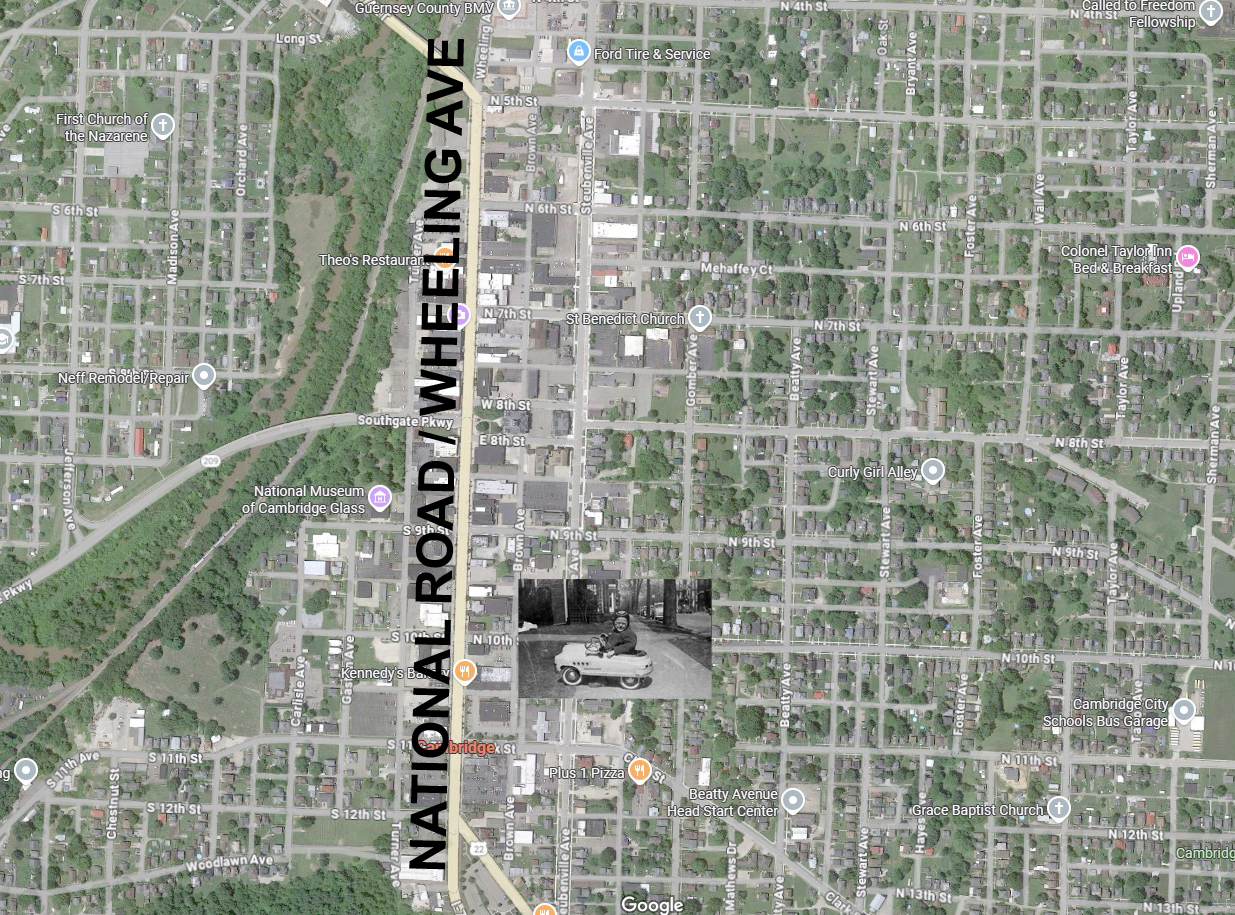
I lived my first four years a few houses just north of Wheeling Avenue, the main street of Cambridge, Ohio, and the original path of the National Road (below). It approached Wills Creek at the west end of town at the top of the map, the site of the first bridge in the newly formed Northwest Territory that only initially had a ferry for crossing. National Road lore has always been a part of my life.

The National Road (previously Zanes Trace and later to be U.S. Route 40 coast to coast) crossed over the double lane covered bridge noted above at Wills Creek, and was built in 1828.

.jpg)
.jpg)
This double lane covered bridge was replaced by a concrete viaduct in 1914 after the disastrous 1913 flood that wiped it out. The new bridge was initially built over dry land adjacent to the creek. The creek was later diverted under it as shown.
Before getting to the rest of the bridges I think it is just as interesting to see what remains of the truly original National Road as it was laid out through the forests of the then new Northwest Territories. Some of those roads still exist in short sections and are on either side of Cambridge.
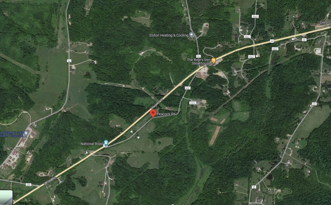
The red marker on the map below marks the path of the original National Road, now called Peacock Road, a few miles east of Cambridge. U.S. Route 40 is shown in yellow and is also known as the National Road when I was growing up. The original National Road became impossible to maneuver after it rained, so in 1918 or thereabouts brick paving was installed in certain sections and still exists and is shown in the following photos.
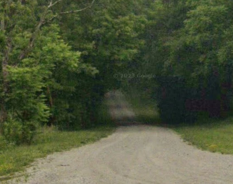
Photos below from Google Maps of the original National Road (currently Peacock Road) and some of the 1918 paving:

West of Cambridge and shown below is the National Road brick paving (now County Road 430) and is in much better condition as it is a road used daily. What’s interesting of course is that this is the same route our ancestors used traveling west.

Interstate 70 generally follows the same path and is located adjacent to the road laid out by our ancestors (including the famous Zane of Zanes Trace fame) shown in these photos. My summer job in college was working on the construction of Interstate 70.
Easterly, not far from Cambridge, is the bridge for the National Road as it crosses the Ohio River at Wheeling, West Virginia. It was actually Virginia at the time of its construction in 1849 and at that time it was the world’s longest suspension bridge. It’s now used only as a bike and pedestrian bridge linking the two states, West Virginia and Ohio. It was designed by Charles Ellet and is shown below as it exists today (note the National Road sign):

And finally, probably the most famous of the bridges along the new National Road are the small S bridges. Their design is derived from the engineering notion of crossing creeks and small rivers at 90 degrees instead of the often angled crossing dictated by the angle of the approaching road bed. These bridges still exist (there are many and some still in use) and as mentioned above there are two examples near where I grew up. It was quite a curiosity when I was a kid out and about around the county on my bike.
The earliest image (taken in 1928) I can find of the 1828 Fox Run S bridge near New Concord, Ohio can be found here.
The photo below is of this same 1828 Fox Run bridge and was taken in 1933. It shows the new adjacent Route 40 which is not in the 1928 photo above because Route 40 linking the country together was yet to be constructed. The S bridge was still in use in 1928.
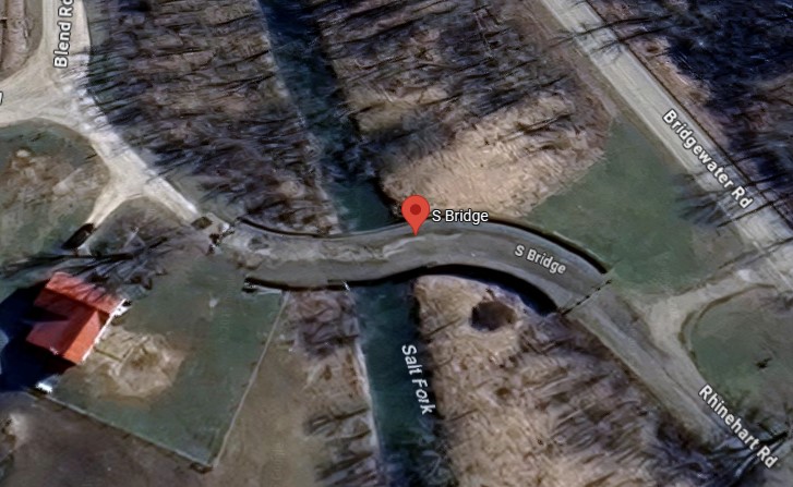
The second S bridge near me growing up is located at the east end of Guernsey County, per the red marker below. It is called the Salt Fork Creek S bridge and its history and photos can be seen here.
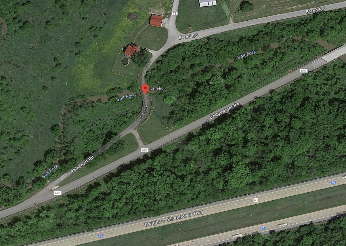
A more current version can be seen in a Google Maps photo below. Presently the bridge is no longer in use the way use was implied by the above photo taken earlier. It was in use when I was growing up.
And finally, below are more current photos of the Fox Run S bridge shown earlier. These bridges, all built by the year 1828, along with the suspension bridge at Wheeling in 1849, which replaced ferry service at the Ohio River, linked the east coast with westward expansion:


Lastly, below is the Petersburg Tollhouse near Addison, PA. It is the last remaining 19thcentury toll house along the original National Road:

Blog post written by Senior Architect, David Tritt.